15 Best Hikes in Bryce Canyon National Park
Bryce Canyon Hikes: Are you looking for the best hikes in Bryce Canyon? The Bryce Canyon Hikes on this list have something for everyone.

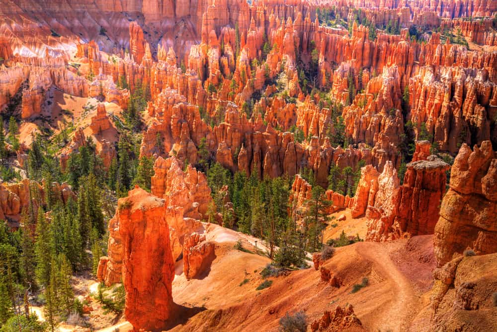
Hiking in Bryce Canyon is one of the best ways to see the beauty of this national park. All the best trails in Bryce Canyon are below the rim!
Hiking at Bryce is so rewarding but don’t worry I have included Bryce Canyon walks.
Thank you for supporting this website written by an American. This post may contain affiliate links. This means I earn a small commission on these links at no extra cost to you.
National Park Entrance Fees
To enter the National Parks, you’ll need to pay an entrance fee or have a National Parks Pass also known as American the Beautiful Pass.
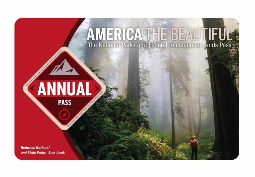
It costs $80 for a yearly America the Beautiful Pass. This gives you access to all national parks and federal areas that charge fees. The America the Beautiful Pass is well worth it!
I purchased my first one in 2016 and it’s such a money-saver! Plus 10% of sale proceeds go to the National Park Foundation.
Tips for Visiting Grand Teton National Park
Grand Canyon National Park is perfect for outdoor enthusiasts. There is something for everyone on this list and for different fitness levels. Also, note that it is dry and hot (in the summer), and make sure you know what you are getting into before you start. Here are a few tips for visiting the Grand Canyon:
- Bring a reusable water bottle and lots of water! Remember you are in the sun and you will need to drink lots of water. I love my LifeStraw Filtered Water Bottle. I can refill this bottle anywhere and it comes with a carabiner to connect it to my daypack.
- Check the Weather – days over 100 degrees are very common. Make sure to check.
- Hiking boots or sandals that will protect your feet! I love good shoes. I need all the support and help I can get. I actually love these sandals for hiking and also love these hiking boots.
- Bring hiking poles for balance and to protect your knees. I know many experienced hikers (and even amateur ones) think that hiking poles are for old people who lose their balance. Actually, hiking poles can help when going down steep inclines or when scrambling over rocks. They are great to hike with even for the most experienced hiker.
- Wear a sunhat. I feel like this whole post is about how high you are in the mountains and how much closer you are to the sun but it is so true. At elevation, you are closer to the sun and more likely to burn. Wear sun protection such as a sun hat and sunscreen.
- Be aware of the wildlife. This is the Southwest and you will need to watch out for snakes and other wildlife such as moose or a bear. Please stay away from wildlife and do not feed them. I recommend carrying bear spray as well.
- Start Early – If you want to avoid the traffic and the heat you will need to start your hike early. That way it will be nice and cool and the smog will not affect you either.
- Leave no trace. If you are new to the concept of Leave No Trace it is all about preserving the environment to ensure it is in the same or better condition when you leave it. This means that you should stick to the trails and carry out everything that you carried in. This is a great explanation of the Leave No Trace principles!
- Water shoes are great for water hikes– If you don’t have a pair, I highly suggest it as they are affordable. I have an article on the pros and cons of several pairs of water shoes.
- Bring Bug Spray and a snack: Be sure to bring everything you need including a snack like a protein bar plus BUG SPRAY.
Where to stay near Grand Canyon National Park
The Grand Canyon makes for a great weekend escape. Fresh air, beautiful scenery and being in nature does a world of good for the soul. I recommend staying as close to the park as possible and even treating yourself with a cabin with a spa pool to relax at night.
- There are lots of fantastic Airbnbs near the Grand Canyon. I have made a list of the best airbnbs around the park wherever you decide to stay. You can also check out my post on Where to Stay near the Grand Canyon to find the perfect hotel for any budget.
If you are taking a road trip remember to reserve a car in advance using Discover Cars .
National Park Entrance Fees
To enter the National Parks, you’ll need to pay an entrance fee or have a National Parks Pass also known as American the Beautiful Pass.
It costs $80 for a yearly America the Beautiful Pass. This gives you access to all national parks and federal areas that charge fees. The America the Beautiful Pass is well worth it!
I purchased my first one in 2016 and it’s such a money-saver! Plus 10% of sale proceeds go to the National Park Foundation.
Tips for Visiting Grand Teton National Park
Grand Canyon National Park is perfect for outdoor enthusiasts. There is something for everyone on this list and for different fitness levels. Also, note that it is dry and hot (in the summer), and make sure you know what you are getting into before you start. Here are a few tips for visiting the Grand Canyon:
- Bring a reusable water bottle and lots of water! Remember you are in the sun and you will need to drink lots of water. I love my LifeStraw Filtered Water Bottle. I can refill this bottle anywhere and it comes with a carabiner to connect it to my daypack.
- Check the Weather – days over 100 degrees are very common. Make sure to check.
- Hiking boots or sandals that will protect your feet! I love good shoes. I need all the support and help I can get. I actually love these sandals for hiking and also love these hiking boots.
- Bring hiking poles for balance and to protect your knees. I know many experienced hikers (and even amateur ones) think that hiking poles are for old people who lose their balance. Actually, hiking poles can help when going down steep inclines or when scrambling over rocks. They are great to hike with even for the most experienced hiker.
- Wear a sunhat. I feel like this whole post is about how high you are in the mountains and how much closer you are to the sun but it is so true. At elevation, you are closer to the sun and more likely to burn. Wear sun protection such as a sun hat and sunscreen.
- Be aware of the wildlife. This is the Southwest and you will need to watch out for snakes and other wildlife such as moose or a bear. Please stay away from wildlife and do not feed them. I recommend carrying bear spray as well.
- Start Early – If you want to avoid the traffic and the heat you will need to start your hike early. That way it will be nice and cool and the smog will not affect you either.
- Leave no trace. If you are new to the concept of Leave No Trace it is all about preserving the environment to ensure it is in the same or better condition when you leave it. This means that you should stick to the trails and carry out everything that you carried in. This is a great explanation of the Leave No Trace principles!
- Water shoes are great for water hikes– If you don’t have a pair, I highly suggest it as they are affordable. I have an article on the pros and cons of several pairs of water shoes.
- Bring Bug Spray and a snack: Be sure to bring everything you need including a snack like a protein bar plus BUG SPRAY.
Where to stay near Grand Canyon National Park
The Grand Canyon makes for a great weekend escape. Fresh air, beautiful scenery and being in nature does a world of good for the soul. I recommend staying as close to the park as possible and even treating yourself with a cabin with a spa pool to relax at night.
- There are lots of fantastic Airbnbs near the Grand Canyon. I have made a list of the best airbnbs around the park wherever you decide to stay. You can also check out my post on Where to Stay near the Grand Canyon to find the perfect hotel for any budget.
If you are taking a road trip remember to reserve a car in advance using Discover Cars .
Navajo Loop
The Navajo Loop, which is lined with Douglas Fir trees, includes “Thor’s Hammer,” “Temple of Osiris,” and breathtaking vistas of the “Silent City,” which is known after its towering rock formations.
When combined with the Queens Garden Trail or the Peek-a-Boo Loop, this trail can take up to two hours to complete.
Bryce Canyon National Park’s Navajo Loop, which is sometimes coupled with Queens Garden Trail, is a popular moderate-intensity hike. This trail is popular among visitors because it is only 1.3 miles long.
Because of the trail’s layout, depending on the month and season you visit, you may experience extreme heat or extreme cold. As a result, it’s critical to plan and dress appropriately.
Peek-a-boo loop
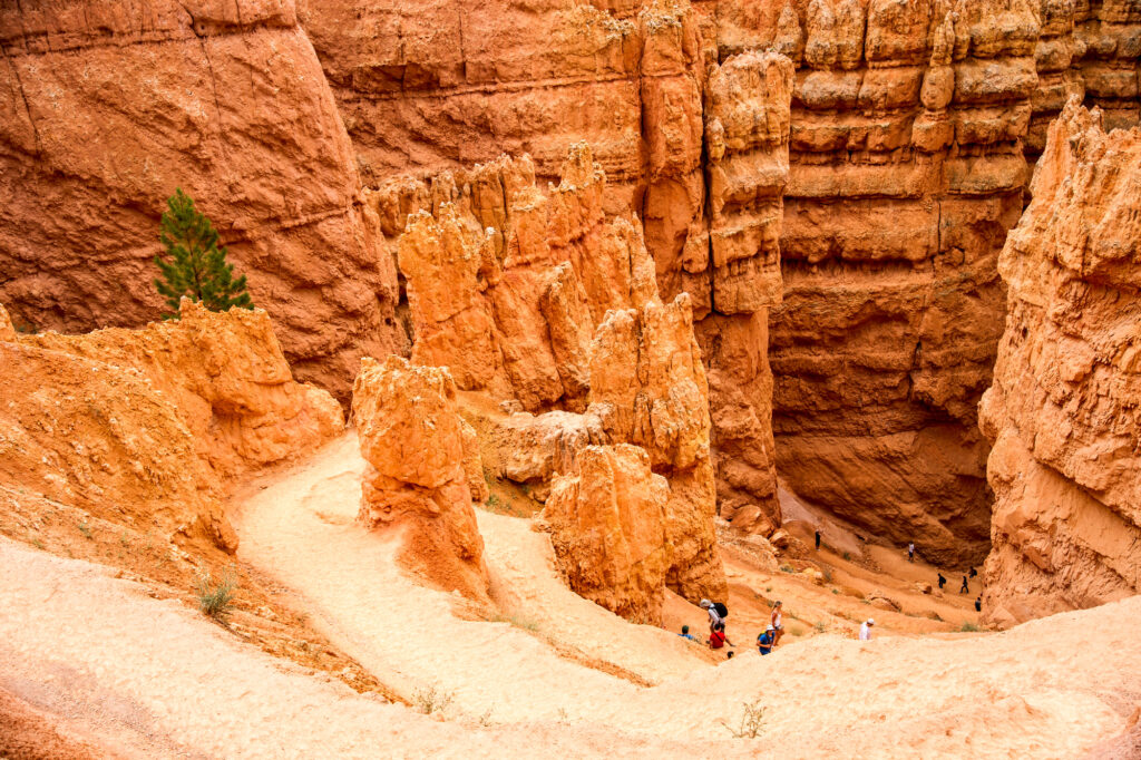
For its beautiful views and challenging terrain, the 5.5-mile Peek-A-Boo Loop Trail, one of the park’s more strenuous climbs, is a favorite among previous visitors. The most well-known stop on this trip is the Wall of Windows, a sandstone formation with hoodoos and arches.
As you explore the trail, you’ll wander among the hoodoos, getting a close look at the unique formation. The trail begins with a stunning descent of 1,555 feet into the canyon. According to hikers, many sections of the trail are steep and in intense sunlight.
Bring plenty of water, snacks, sunscreen, and strong hiking shoes with you. You should be aware that you’ll be sharing the path with equestrians, and the park suggests that you give them the right of way. In addition, this trail can only be traveled in one direction: clockwise.
This hike is classified as difficult because of the abrupt height drop and, in particular, the climb back up.
Fairyland Loop
Fairyland Loop — This 7.6-mile looping track is considered a challenging hike by some, and it may leave you panting for air. The long hike is worth it, though, because it passes by stunning hoodoos such as the Pink Cliffs and Claron Formations, with the most scenic vistas at the trail’s beginning and end.
Because of the trail’s length and variable elevation, it’s best to apply a thick layer of sunscreen and pack lots of snacks and drink with you. If you feel tired or have an emergency, there is also a free shuttle service that goes from the trail to Sunrise Point.
Take a drink and some food with you because you’ll be starting your ascent to your destination. As you re-enter the route, you’ll see vistas of the Chinese Wall before rejoining the Rim Trail. Go back along the rim to reach Fairyland Point.
The wonderful thing is that this trail is less traveled by others due to its length and intensity, making for a much quieter experience than others.
Queens Garden Trail
Queens Garden is a famous trail in Bryce Canyon National Park. It is one of the park’s two most popular routes. This hike will take you down into the rock formations for a visually beautiful descent.
The first part of the hike, which is primarily gravel and downhill, may be difficult for young walkers. It may be slippery for little children and there is a high drop-off, thus, handholding is advised. Trekking poles are really useful for those who are a little unsteady. There are panoramic vistas of Bryce Canyon and a handful of excellent tunnels to explore. The trail comes to an end at the valley floor, where you can take a break and enjoy some shade.
If you choose to carry on that far, the trail will eventually fall into a forest-like environment. The trail eventually connects with the Navajo Loop, bringing you back to where you started.
This 1.8-mile track, which begins near Sunrise Point, is best accessed between April and November and is a pleasant walk for most people. Along the way, you’ll come across the Queen’s Garden, which has various rock formations in a range of colors that are claimed to resemble Queen Victoria, hence the name.
Rim Trail
The Rim Trail, which is best utilized from March to November, is roughly 10.7 miles round trip. Though the trail has two separate ways, you will gain around 1,587 feet of elevation.
If all you want from your Bryce Canyon trip is sweeping vistas of the hoodoos, choose the Rim Trail. The route winds its way up to the top of the amphitheater, offering breathtaking views in all directions. Inspiration, Sunrise, and Sunset points, as well as Fairyland and Bryce Points, are all located along the 5.5-mile one-way path.
The first path is roughly 0.9 miles long and suited for people of all skill types. It is a flat trail that takes around 40 minutes to complete and is located between Sunrise and Sunset Points. The second trail is for intermediate hikers and runs between Fairyland Point and Bryce Point. It has a one-way length of 5.5 miles. Along this path, keep an eye out for elevation changes.
Previous visitors appreciated the paved section between Sunset and Sunrise points as making the Rim Trail a rather easy walk. They also enjoyed the plentiful and enticing surroundings. On this trail, you can walk as much or as little as you choose.
Hat Shop Trail
The Hat Shop Trail begins at Bryce Point and is a down and back trail. It isn’t a loop at all.
This strenuous climb provides long views of the Grand Staircase’s multicolored cliffs to the south, as well as quiet solitude in which to enjoy them. Hikers descend approximately 1500 feet (457 meters) in the first 2 miles (3.2 kilometers) of the much longer Under-the-Rim Wilderness Trail before turning around and climbing 2 miles (3.2 kilometers) again. Balanced-rock hoodoos line the trail’s edge at the turning point. These thin, orange pinnacles are crowned by enormous grey rocks, giving them a unique aspect from the hoodoos found to the north in the Bryce Amphitheater.
Visitors with “bad knees” should take particular caution due to the steep descent. The hike back to the top is seen as a feat in and of itself. The Hat Shop Trail is not recommended in the winter unless you are extremely well prepared for ice, deep snow, and other winter conditions.
Visitors who want to go backcountry camping on the Under-the-Rim Trail must first get a permit from the Visitor Center.
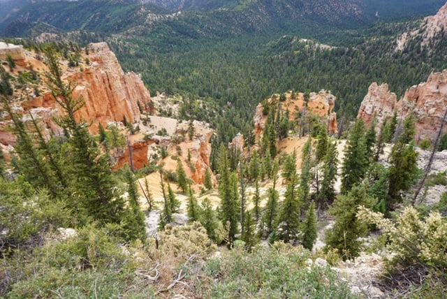
Bristlecone Loop Trail
The Bristlecone Loop, which may be reached from Rainbow Point at the park’s southern end, meanders through the forest above the park’s highest point, reaching elevations of over 9,100 feet (2778 m). You’ll travel by 1,800-year-old bristlecone pines and see vistas that stretch to the Four Corners.
Grouse, woodpeckers, owls, and a variety of squirrels and chipmunks thrive in this forest, which is dominated by Blue Spruce, Douglas Fir, and White Fir. Ravens and Steller’s Jays are also likely to be seen here. These bird species serve as crucial reminders that, while many plants and animals are restricted to specific types of habitat, others may thrive in a range of locations.
The path winds southeast from the trailhead through deep areas of white fir, Douglas fir, and ponderosa pine. The trail continues to the cliffs and canyon rim. Bristlecone pines flourish atop the rim’s wide, windy cliffs. The trail crosses the Under the Rim Trail on its way back to Rainbow Point. Hikers can return to the starting place by following the trail signage.
Due to snow depths ranging from 2 to 15 feet, this trail may be inaccessible in the middle of the winter (.7-5 m)
Mossy Cave
The Mossy Cave path is one of the park’s lowest elevation walks, and one of the few that begins with a climb and ends with a drop, since most day hikes in the park begin with descent and end with a climb. It’s also the park’s northernmost trek, located just off SR 12 as it winds its way around the park’s edge.
The Mossy Cave Trail has two pathways, one of which does not descend into the amphitheater. One approach leads to a waterfall by following an artificial stream built by pioneers and the other leads to Mossy Cave, a cave. The moss is frequently replaced by icicles in the winter, creating a distinct and equally “chilling” picture.
This lovely, short route follows a river to a dripping cave and then on to a spectacular waterfall. The red rocks contrast well with the dark green greenery surrounding the river. This hike is both relaxing and easy to complete.
This area is mossy in the summer and covered in icicles in the winter. Thanks to the presence of an irrigation channel built by local pioneers in the early 1890s, water flows regularly through Water Canyon on its way from the Tropic Reservoir east of the park to settlements in the Paria Valley.
Sunset Point
After spending many hours among the colorful rock formations and cliffs, it’s time to bid a fond farewell to your day at Bryce Canyon. The sunset at Bryce Amphitheater puts on a fantastic natural show to conclude the day, so you’re in luck.
Bryce Canyon’s most popular hike. Sunset Point is home to some of the area’s most breathtaking limestone rock formations. Thor’s Hammer, a long-time popular rock structure among visitors, is featured on the hike, with red, yellow, and orange colors. As the sun sets below the canyon rim, the blue sky will turn pink and lavender. As the sun sets, the hoodoos sparkle like candelabra, casting shadows across the canyon.
Sunset Point is also an excellent spot for birdwatching. Throughout your hike, look for ravens and hawks as they soar overhead, as well as a variety of swallows and swifts.
This hike is 1.1 miles long and isn’t as popular as others. It is an out and back route, which means that after you reach the end of the trail, you must return in the same manner to reach the start.
Sunrise Point
Bryce Canyon is one of the most photographed national parks due to the magnificent tapestry of hues that emerge when the sun rises over Bryce Amphitheater. It’s an excellent place to see the dawn because all of the overlooks here face east. When the sun first peeks over the cliffs, the world’s greatest collection of hoodoos will be at their most luminous: blazing orange, soft ivory, and pastel pink will be a beautiful sight to behold.
Sunrise Point trek provides a panoramic perspective of Bryce Canyon National Park and offers breathtaking vistas of various locations. The Boat Mesa, the Pink Cliffs, the Sinking Ship, and the Aquarius Plateau are just a few of the sights to see.
Even if you’re not a morning person, waking up early to see this incredible blend of colors is well worth the effort. Plan on staying for at least an hour to get the most out of it.
This is supposed to be a fantastic site to camp out to watch the sunrise because of its spectacular outlook. There are other facilities where you may buy refreshments, use the restroom, do laundry, get water, and more near the trailhead.
Agua Canyon
The lookout near mile 13.5 of the park road in Bryce Canyon National Park provides the best view of Agua Canyon. The beautiful view from above is certainly worth the stop, even though no paths are leading down to the canyon from here. Please keep in mind that this stretch of road is frequently closed due to snowstorms if you visit in the winter.
The Agua Canyon Viewpoint offers views of two spectacular hoodoos. The “Rabbit” or “Backpacker” hoodoo is located to the right. This one features a narrower waist and a broader top. This one is shaped more like a wide tower. Several hoodoos have fallen or partially collapsed, according to the park, and no longer resemble the objects for which they were named.
In addition to the canyon views and hoodoos, Navajo Mountain, at 10,387 feet, may be seen on the horizon.
Tower Bridge
The Tower Bridge Trail is a great intermediate-distance hike for visitors to Bryce Canyon National Park. View the Chinese Wall and Crescent Castles, two of the most iconic hoodoo structures in Bryce Canyon National Park. The big show-stopper, the Tower Bridge, awaits you around the halfway point of this hike.
This three-mile out-and-back trail descends for a beautiful perspective of the Tower Bridge itself. It takes two to three hours to finish and is densely forested with snakes and other fauna.
Views of the “Sinking Ship” and “China Wall” are among the many attractions along this less-traveled path. At about 0.75 miles into your trek, you’ll come across beautiful rock formations, including an incredible vista of a massive white wall with a tiny window.
The rock formations and scenery may appear quite different when you return the way you came, making both the journey to the finish and the return well worth your time. This hike is suitable for families and features relatively flat terrain with very few rocks.
Inspiration Point
Since you can see the Bryce Amphitheater from three different views, Inspiration Point is one of the top things to do in Bryce Canyon in one day. There are three separate viewpoints here, each with a unique perspective on the thousands of hoodoos that make up the canyon.
From a three-tiered perspective, Inspiration Point can be seen as a diverse collection of hoodoos. From this vantage point, you can see Silent City, Boat Mesa, and the Claron Formation.
The Inspiration Point trek, which is about.6 miles long, has lower, middle, and upper points. Despite the breathtaking scenery, you must exercise caution. Many of the cliffs and slopes at Inspiration Point are built of unstable and crumbly rock. Keep yourself and your children well back from the edges and behind the rails.
Inspiration Point, like Bryce Point, is best viewed early in the morning, but it is beautiful at any time of day! Spend some time savoring the view from all three platforms and taking in the spectacular beauty of the Bryce Amphitheater!
Bryce Point
Bryce Point is one of the most popular places to see the amphitheater in its entirety. It’s regarded to be one of the best spots in the park to see the sunrise, as the tops of the hoodoos come alive with the coming of the sun, making it one of Bryce Canyon’s most beautiful sights.
Even though there will be a fence along the cliff to deter guests from getting too close to the edge, the view is still spectacular. You’ll get a panoramic view of the amphitheater as well as a bird’s eye perspective of the hoodoos from Bryce Points, which is located at an elevation of 8300 feet.
The Claron Formation and Boat Mesa can both be seen here. There will be lots of wildlife to observe along the way, including the Uinta chipmunk, Golden-Mantled squirrels, and other rodents.
Please, as tempting as it may be, refrain from feeding the animals you encounter on your trip. While you may believe you are being kind, feeding the animals along your hike can make them sick. Please keep this in mind and inform your children about it before you arrange your trip.
It’s said to be especially beautiful around sunrise, because of Bryce Point’s unique location among the park’s other overlooks, but the view is stunning at any time of day!
Rainbow Point
Rainbow Point is one of Bryce Canyon National Park’s southernmost viewpoints. It provides a fantastic perspective of the park, especially the famous Amphitheatre. Rainbow Point is mostly paved and is only a short distance from the area’s parking lot.
Rainbow Point, at 9,115 feet above sea level, is one of the park’s highest elevation peaks and offers a panoramic view of the park. On a clear day, it is said that one can see Arizona from this point.
It’s recommended to begin your Bryce Canyon National Park motor trip by going straight to the park’s extreme southern end. From Rainbow Point, you can see the entire park stretching out in front of you to the north.
The Grand Staircase, as well as the Pink and Red Vermillion Cliffs, may be seen from this vantage point.