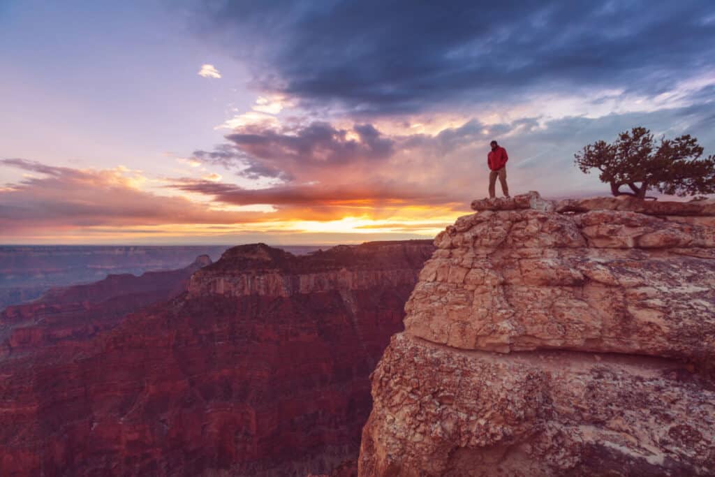
Visiting the Grand Canyon in June is a great time to visit. June is a busy time to visit but the crowds are starting to arrive especially toward the end of the month.
I’ve included all of the things to do in the Grand Canyon in June and tips and tricks for visiting. You can also use the Grand Canyon self guided tour to learn more about the Grand Canyon when you visit.
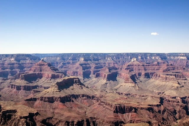
Weather in the Grand Canyon in June
In May, the daytime maximum temperature is 82 degrees Fahrenheit (25 degrees Celsius), while the overnight minimum is 48 degrees Fahrenheit (9 degree Celsius). The Grand Canyon covers a huge area and each section has a varied temperature.
Thank you for supporting this website written by an American. This post may contain affiliate links. This means I earn a small commission on these links at no extra cost to you.
National Park Entrance Fees
To enter the National Parks, you’ll need to pay an entrance fee or have a National Parks Pass also known as American the Beautiful Pass.
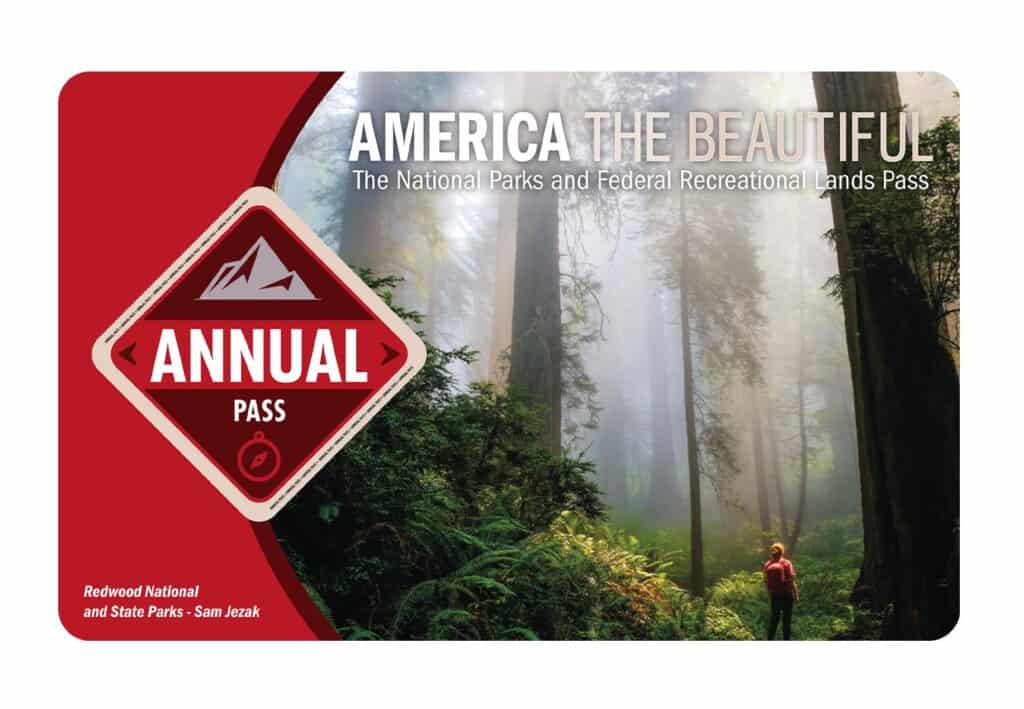
It costs $80 for a yearly America the Beautiful Pass. This gives you access to all national parks and federal areas that charge fees. The America the Beautiful Pass is well worth it!
I purchased my first one in 2016 and it’s such a money-saver! Plus 10% of sale proceeds go to the National Park Foundation.
Tips for Visiting Grand Teton National Park
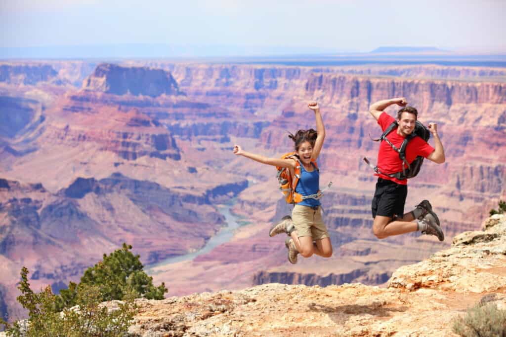
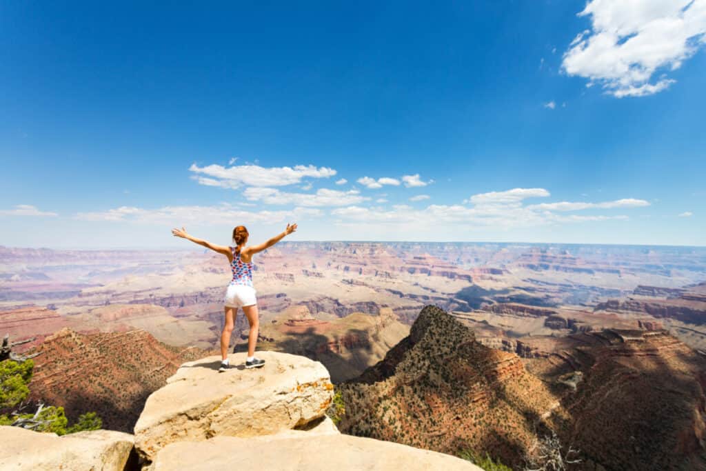
Grand Canyon National Park is perfect for outdoor enthusiasts. There is something for everyone on this list and for different fitness levels. Also, note that it is dry and hot (in the summer), and make sure you know what you are getting into before you start. Here are a few tips for visiting the Grand Canyon:
- Bring a reusable water bottle and lots of water! Remember you are in the sun and you will need to drink lots of water. I love my LifeStraw Filtered Water Bottle. I can refill this bottle anywhere and it comes with a carabiner to connect it to my daypack.
- Check the Weather – days over 100 degrees are very common. Make sure to check.
- Hiking boots or sandals that will protect your feet! I love good shoes. I need all the support and help I can get. I actually love these sandals for hiking and also love these hiking boots.
- Bring hiking poles for balance and to protect your knees. I know many experienced hikers (and even amateur ones) think that hiking poles are for old people who lose their balance. Actually, hiking poles can help when going down steep inclines or when scrambling over rocks. They are great to hike with even for the most experienced hiker.
- Wear a sunhat. I feel like this whole post is about how high you are in the mountains and how much closer you are to the sun but it is so true. At elevation, you are closer to the sun and more likely to burn. Wear sun protection such as a sun hat and sunscreen.
- Be aware of the wildlife. This is the Southwest and you will need to watch out for snakes and other wildlife such as moose or a bear. Please stay away from wildlife and do not feed them. I recommend carrying bear spray as well.
- Start Early – If you want to avoid the traffic and the heat you will need to start your hike early. That way it will be nice and cool and the smog will not affect you either.
- Leave no trace. If you are new to the concept of Leave No Trace it is all about preserving the environment to ensure it is in the same or better condition when you leave it. This means that you should stick to the trails and carry out everything that you carried in. This is a great explanation of the Leave No Trace principles!
- Water shoes are great for water hikes– If you don’t have a pair, I highly suggest it as they are affordable. I have an article on the pros and cons of several pairs of water shoes.
- Bring Bug Spray and a snack: Be sure to bring everything you need including a snack like a protein bar plus BUG SPRAY.
Where to stay near Grand Canyon National Park
The Grand Canyon makes for a great weekend escape. Fresh air, beautiful scenery and being in nature does a world of good for the soul. I recommend staying as close to the park as possible and even treating yourself with a cabin with a spa pool to relax at night.
- There are lots of fantastic Airbnbs near the Grand Canyon. I have made a list of the best airbnbs around the park wherever you decide to stay. You can also check out my post on Where to Stay near the Grand Canyon to find the perfect hotel for any budget.
If you are taking a road trip remember to reserve a car in advance using Discover Cars .
15 Things to do in the Grand Canyon in May
Grand Canyon South Rim: Self-Guided Tour
See a natural wonder of the world in person on this self-guided driving tour of the Grand Canyon’s South Rim.
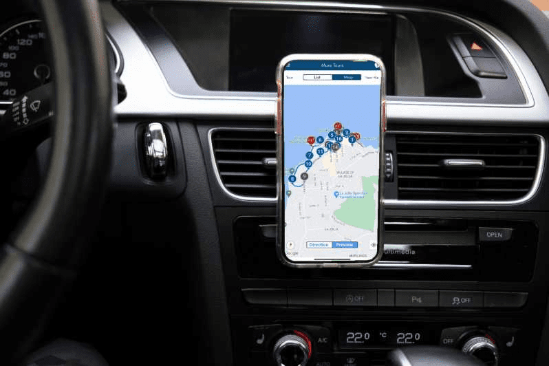
This self-guided driving tour takes you to all the best vistas, hikes, and attractions along Grand Canyon’s South Rim and tells you the secret history behind this famous landscape. Walk the scenic South Rim Trail, catch a sunset at Mather Point, and much more.
Hopi Point
The Grand Canyon’s South Rim’s most breathtaking vista may be reached by hiking to Hopi Point on the Rim Trail.
Hopi Point has the best views of Shiva Temple, Iris Temple, Horus Temple, and other temples since it extends farther north into the canyon than any other vantage point. Nearly the whole canyon is visible, all the way to Havasupai Point.
This easy hike covers 6.1 kilometers with a small rise in elevation. It is appropriate for people of all ages and abilities, giving it not only a beautiful but also a reachable viewpoint. You can hike further from Hopi Point to other surrounding overlooks or simply stay for a while to take it all in. On this road, be prepared for heavy traffic.
Hopi Point is relatively easy to get to for such a magnificent outlook. The trailhead for this route is where the Hermits Rest Route Transfer Station and Village Route Transfer Station meet.
Hike on the West Rim Trail as it parallels Hermit Road from the trailhead away from the hamlet. The path then turns away from the highway and begins to head north, following the rim. When the Trailview Overlook appears on your right, you can pause there for a halfway vista.
Take in everything and take pictures. You can hear how silent and quiet the air is over this enormous wonder if you’re fortunate enough to arrive when few others are.
When you’re prepared, take the same path you hiked on to reach the village. As an alternative, you can continue going along the Rim Trail to see more vistas.
Desert View Watchtower
The design aims to incorporate features from indigenous cultures and blend in with the Grand Canyon’s surrounding environment. Beautiful, recently restored murals with tribal art and pictographs may be found inside the tower.
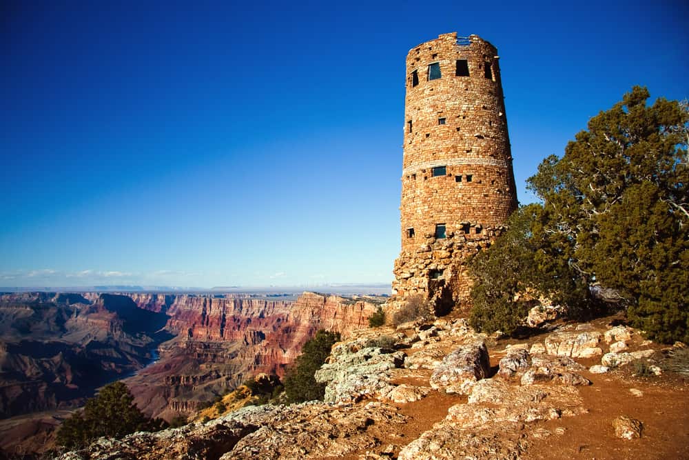
The Desert View Watchtower was once a gift shop, but it has recently been converted back to serve as a scenic rest area for visitors. The tower is 5 floors tall with various experiences on each level.
Currently, the park does not provide a shuttle service to get you to Desert View Watchtower; instead, you must use your vehicle or a private tour bus (or a bicycle).
It takes 40 minutes to get to Desert View Watchtower from Grand Canyon Village (25 miles). Additionally, you can view the Colorado River from Desert View. The canyon comes alive at sunset with brilliant crimson and purple hues that seem to last forever.
Helicopter Tour
Fly in elegance to the Grand Canyon with a helicopter ride!
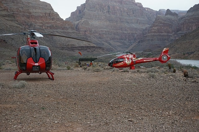
Land at the South or West Rim of the Grand Canyon, soar above the North Rim, descend to the Canyon’s floor, or fly over the flashing lights of the Las Vegas Strip. All forward-facing seats in our helicopters have panoramic windows that provide unobstructed views.
There are helicopter tours available to the South, West, and North Rims of the Grand Canyon as well as above the Las Vegas Strip. You can fly to the Grand Canyon and land on the Canyon floor, which is 4,000 feet below the Rim, or you can fly along the Canyon’s rim.
The luxury “flightseeing” helicopters used on all of the helicopter trips are built exclusively for sightseeing; they include forward-facing seats, 180-degree unrestricted views, and digital voice narration in several languages. Tours by bus, boat, and airplane can all be coupled with helicopter flights.
Visitors who want to experience the Grand Canyon from above, get close to the canyon floor, or just amp up the adventure will find Grand Canyon helicopter tours to be the perfect option. In search of luxury? Most hotels on the Strip offer limousine pickup and drop-off as part of some helicopter tours.
Mather Point
Visitors entering the park at the south entrance will first come upon Mather Point, one of the canyon viewpoints.
When viewing the Canyon for the first time, visitors can be amazed by the 10 miles that separate this location from the North Rim, gaze into the mile-deep abyss, consider the force of the Colorado River snaking below, and take in the vivid Kaibab Limestone, Coconino Sandstone, and Vishnu Schist rock layers that are visible.
Two views at the location have safety rails constructed on rocks that extend into the canyon. The vista extends from Yaki Point in the east, where the South Kaibab Trail starts, to Bright Angel Trail, which is located west of the point.
Between them, it’s also possible to see Pipe Creek, O’Neill Butte, and the Tonto Trail. Bright Angel Creek can be observed flowing for ten miles via several buttes and ravines if one looks towards the North Rim.
The NPS is currently developing a rim-side amphitheater, a new shuttle bus stop, picnic spots, and more parking spaces in the Mather Point area to enhance visitor experiences.
By hiking the rim route east from Grand Canyon Village, taking a personal vehicle, or using the park’s free shuttle service, visitors can get to Mather Point.
Lipan Point
Lipan Point is located on a small hilltop that would have a 360-degree view if it weren’t for the pine forest on the east side, half a mile north of the main scenic drive.
To get there, you must take a spur road that climbs 80 feet to the parking area. The 8-mile Tanner Trail’s starting location is a short distance from the parking area.
The point overlooks Seventy-five Mile Creek and its tributaries, which enter the Colorado River between two of the river’s more than 100 sets of rapids, Nevills and Hance, and run beneath a slender ridge connected to Escalante Butte (which are just visible to the west). The beginning of the inner canyon valley, when the Colorado first cuts into the ancient Vishnu Schist, is located just downstream of Hance Rapids.
A nice view of the largest vertical, 2,000-foot cliffs below Pinal Point, the following designated promontory along the rim, may be found south of Seventy-Five Mile Creek. Moving eastward, beyond Escalante Butte lies the Unkar Delta, a section of banded sandstone that has been worn into rounded hills, a striking contrast to the often angular rocks of the Grand Canyon.
The Colorado River encounters yet another set of rapids at this point, but it also flows around several wide, sandy bends that would be perfect camping spots for groups rafting down the river—if the area weren’t closed off to preserve numerous well-preserved Anasazi ruins that can be found on the slopes surrounding the creek.
Plateau Point
Although the Plateau Point Trail, which is 1.5 miles long, is not particularly challenging, the entire adventure—from the South Rim Trail to the beautiful viewpoint—is 12 miles round trip.
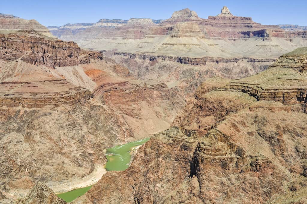
Just past the ranger station and mule corrals at the northern end of Indian Garden, the Plateau Point Trail begins. After crossing Garden Creek and leaving the shade behind, continue west along the Plateau Point Trail. Observe the Tapeats sandstone’s contours as it crosses a dry plateau and a series of ravines. There is no shade here; instead, cacti and other vegetation cover the generally level desert terrain.
Turn right to head northeast at the intersection of the West Tonto Trail and the fork. From here, you can almost directly ascend across the Tonto Platform to the viewpoint. To get to a flat top rock and viewing platform, pass a water tank and mule hitching post. See if you can spot rafters navigating Horn Rapid while admiring the breathtaking scenery (so-called by the two huge protruding rocks at the beginning of the rapid, making this an easy place to get stuck).
Shoshone Point
Just west of milepost 246 on Desert View Drive, there is a gate and an unmarked parking area where the Shoshone Point Trail starts. The peaceful trail is a mile-long, mostly level dirt road that gains only 100 feet. Hiking through a ponderosa pine-covered forest will allow you to cross the plateau.
The turnaround a loop, where there are chairs, grills, mule hitching posts, and pit toilets, is after a mile. You can rent the covered pavilion for gatherings, but you don’t need a permit to simply go to the overlook.
Although there are beautiful views of the eastern Grand Canyon from this rim, thrill seekers continue to the extreme edge of Shoshone Point. A fall could be fatal because of the loose rock and small ledges, so take caution.
Look at the interesting rock formation at the spot that resembles a mushroom and a headstone. Find out if you can spot the Hance Rapids, Desert View Tower, Vishnu Temple, Horseshoe Mesa, and other notable locations.
Enjoy the peace of this deserted gem before returning to the parking lot. In addition, many people come here to view sunsets (bring a headlamp for the hike back).
Yavapai Observation Station
Yavapai Point boasts great views but has a small parking lot and officially doesn’t allow vehicles longer than 22 feet. The Yavapai Observation Station, a visitor center nearby that sells books and has exhibits about the geology and history of the Grand Canyon, is a short stroll to the west from Mather Point.

Since Yavapai is the most northerly and closest to the Colorado River of the three sites on this section of the south rim, it offers possibly the best panoramic views up and down the gorge. At the western end of Pipe Creek, where Plateau Point is located and may be reached via a branch of the Bright Angel Trail, the river is just visible to the north.
The near ground is dominated in the other direction by a long, thin ridge that starts at Yaki Point and extends two-thirds of the way to the river. Peaks and points can be seen above and off in the distance, all the way to Desert View and Palisades of the Desert. The Colorado River crosses three sizable gorges on the North Rim while Trinity Creek enters the river close to Hopi Point from beneath Shiva Temple in the west.
Bright Angel Canyon, a length of straight drainage directly across from Yavapai Point, is the only maintained rim-to-river path on the north side of Colorado. A few kilometers to the east, Clear Creek creates a long, twisted canyon that stretches northward above Cape Royal towards the distant Walhalla Plateau.
Grand Canyon Village
The majority of people arrive at Grand Canyon Village on the South Rim of Grand Canyon National Park to view the canyon. The majesty of the Grand Canyon is enhanced by sites and attractions.
Many visitors from the East Coast and Midwest journeyed by train in the early 1900s to see the legendary Grand Canyon for themselves—it had been depicted on postcards and described by early explorers. The Grand Canyon and El Tovar were both close by when passengers arrived by train at the Grand Canyon Railway Depot back then. It still functions as an operating depot today, connecting guests to Williams’ Grand Canyon Railway Hotel, a well-liked choice for families arranging extended trips in northern Arizona.
Grand Canyon Village is the starting point for many of the most well-known hiking paths in the Grand Canyon, including the Bright Angel Trail, which is the most popular hike into the canyon.
Day trippers can walk the first mile or two to get a taste of the adventure, but experienced hikers typically prepare months in advance to hike Bright Angel. As you descend, the lively village rapidly gives way to a peaceful setting. If the weather is hot, you shouldn’t do this hike because it takes twice as long to go out as it does to hike in.
Given the surrounding natural splendor, many tourists opt to incorporate camping into their trip to the Grand Canyon. Open all year round, Mather Campground in Grand Canyon Village offers tent camping and pull-through RV parking. RV tourists frequently stop at Trailer Village, located just outside the village. Visitors to the South Rim can also discover a wide selection of cabins and campsites in Williams, nearby.
Toroweap Overlook
The breathtaking Toroweap Overlook, also known as Toroweap Point or just Tuweep, offers a close-up view of the canyon, many volcanic ash mounds, and lava flows. The most stunning photos of the Grand Canyon are obtained from this projecting pinnacle, which rises 2887 feet above the Colorado River.
Toroweap Point allows you to experience the Grand Canyon for what it truly is: a deep, breathtaking gorge sculpted out by erosion brought on by the Colorado River. This is in contrast to the more popular overlooks of the South Rim and North Rim.
Of course, stopping to take in the view from the Toroweap Overlook is an experience in and of itself worth the effort of getting there, but once you’re there, you can also explore many other stunning overlooks by going on hiking trails, like the Tuckup Trail, which may be especially interesting for those who are fascinated by the geology of the area, the Saddle Horse Loop Trail, which offers breathtaking views of the Colorado River, and the Whitmore Trail, a 4-mile trail.
North Rim
The Grand Canyon’s North Rim is undoubtedly the best part of the park, even though the South Rim may get more visitors. The North Rim has far more agreeable summertime temperatures and is calmer and more picturesque.
The Utah border is exceptionally close to the Grand Canyon North Rim. Visits to the North Rim demand more effort than those to the South Rim. Due to its increased isolation, the north side will see fewer visitors. One of the seven natural wonders of the world must be explored from the north side to be fully appreciated.
Havasupai Garden
Havasupai Garden is a great place to start a Grand Canyon backpacking trip at any time of year or for a summer hike into the Canyon. You can pack all you need for a memorable hike into three days! You can stay at Havasupai Garden for two nights and take advantage of the water and shade provided by this magnificent oasis. Consider going to the Colorado River as well, where you may take in breathtaking vistas and spend time at Plateau Point, making for an incredible canyon experience all over.
To reach the shaded oasis of Havasupai Garden, which for generations served as a seasonal agricultural plot for the Havasupai Indians, you will descend Bright Angel, the most well-known trail in the park. The Red Wall’s soaring limestone cliffs will be visible above you, and views of the Canyon’s North Rim will be visible in front of you.
Try hiking to Plateau Point for a sunset dinner and then continuing on a long, thrilling climb to the canyon’s very bottom the next day. On day 3, you’ll partake in one last unforgettable meal in the Grand Canyon before returning down the Bright Angel Trail.
Redwall Bridge
The most difficult and least traveled of the main inner canyon paths at Grand Canyon National Park is the North Kaibab Trail. Hikers can see glimpses of the huge sweep of Bright Angel Canyon via fir trees, aspen, ferns, and wildflowers as they begin 1,000 feet (305 m) higher than South Rim trails.
The current North Kaibab Trail replaced an older path that was notorious for crossing Bright Angel Creek 94 times during construction in the 1920s to match the quality and grade of the South Kaibab Trail (the present-day trail crosses only 6 times). Despite being expertly built and maintained, the North Kaibab Trail is difficult for both day hikers and rim-to-rim hikers.
The trail approaches the remarkable Supai Tunnel after a steep initial descent down the head of a side canyon via multiple switchbacks through lush vegetation and excellent views below the trailhead. There isn’t a phone for emergencies.
Switchbacks lead up to the Redwall Limestone’s enormous cliffs, where for some distances the trail has been blasted out of the cliff. The Redwall segment is breathtaking in every sense; the amazing exposure and views stand in stark contrast to the architectural marvel that made it possible to reach this point.
The remainder of the trail’s descent from Redwall Bridge meets the flatter Bright Angel Canyon and Roaring Springs bottoms. Here, water pours directly from the rocks and cascades over fern and moss to create Bright Angel Creek (which will be a constant companion to the Colorado River). Every resident and visitor of Grand Canyon National Park has access to clean drinking water thanks to this enormous spring. A pipeline hidden beneath the North Kaibab Trail transports the water to the South Rim (installed 1965 – 1970).
From Bright Angel Trail, you can see this spectacular pipeline as it crosses the Colorado River at the bottom of the Silver Bridge.