
Capitol Reef Hiking Guide: Are you looking for the best hikes in Capitol Reef National Park? There is a hiking trail in Capitol Reef for everyone. Hiking in Capitol Reef is the number one thing to do in the park.
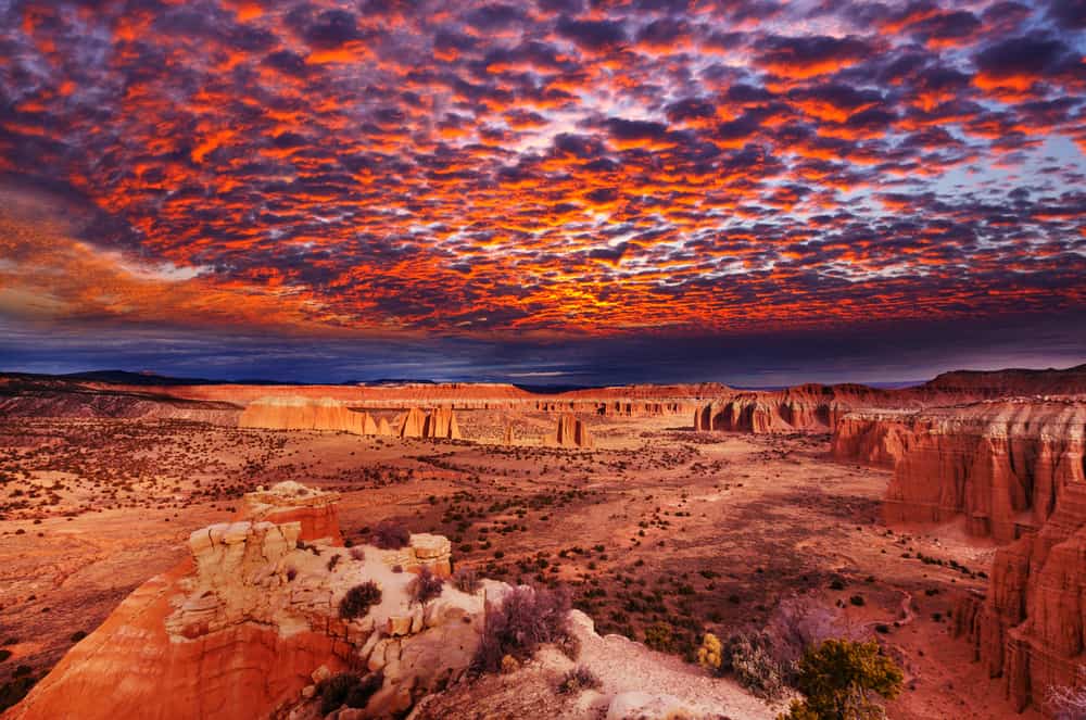
Going on a Capitol Reef Hike is one of the best ways to see the park. This list of Capitol Reef trails will help you plan your trip.
15 Amazing Capitol Reef Hiking Trails – For all Fitness Levels!
Cassidy Arch Trail
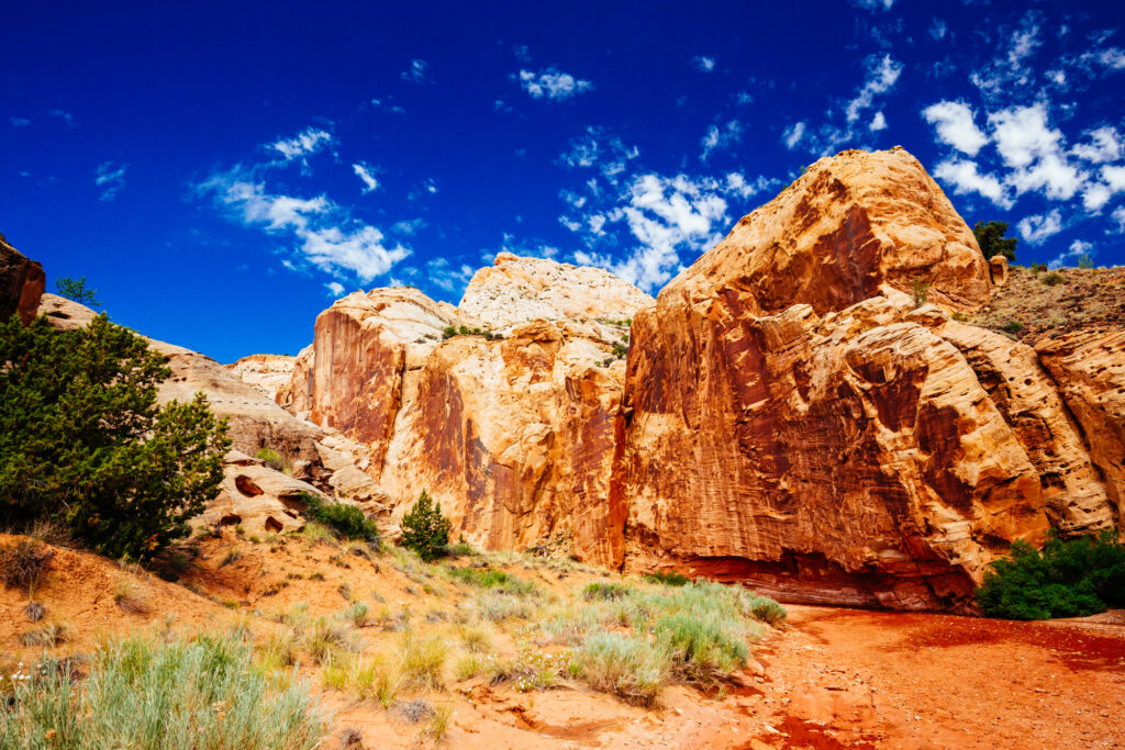
Within the western walls of Grand Wash, it is located in the center section of Capitol Reef National Park.
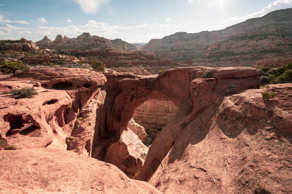
A few hundred yards after passing the Grand Wash Trail parking lot, you’ll find the Cassidy Arch Trail sign on your left. Butch Cassidy, the infamous outlaw who used to hide in the crannies and nooks of the canyons with Sundance Kid, inspired the name, Cassidy.
A nice stroll through Grand Wash begins the trail to Cassidy Arch. The walk starts at the Grand Wash trailhead parking lot’s northeast end and heads east for 0.1 miles along a bench on the north side of the wash before descending to and continuing along with the wash.
On the left (north) side of the wash, look for a sign indicating the start of the Cassidy Arch and Fryingpan pathways at 0.25 miles.
The Cassidy Arch walk climbs steeply from Grand Wash to the cliffs above the arch, providing breathtaking views. The hike is 3.5 miles round trip and is considered strenuous.
Hickman Bridge
One of the most notable characteristics of Hickman Bridge is that it is well-marked, ensuring that no one gets lost.
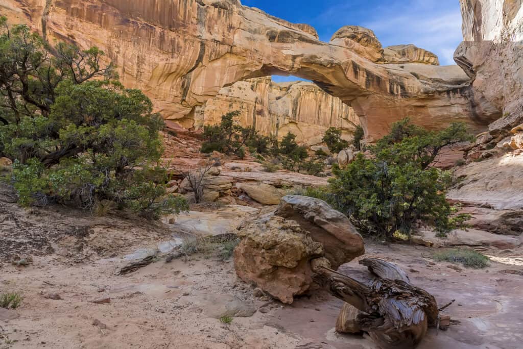
It’s also highly accessible, being only two kilometers from the Visitor Center. This 0.9-mile walk is still the most popular since it provides hikers with a breathtaking view.
Smooth spherical-shaped imprints in the rock may be found in several places as if the walls had been chiseled out by an ice cream scooper. At the trail’s finish, you’ll see a massive natural rock bridge that matches many of the formations in Arches National Park.
The orange-colored bridge is eye-catching, and the view from below is spectacular. By venturing off the established path, you can try out new perspectives. If you only do one hike in the park, make it this one.
The trail isn’t particularly lengthy or steep, but it does lead to some magnificent sights, including a large arch, a small arch, and the ruins of a Fremont pit house.
During the spring and fall seasons, the site is very popular, so if you plan on visiting during these times, get there early. This way, you will be able to avoid crowds while simultaneously finding a parking spot.
Frying Pan Trail
The Frying Pan is a fun hike that will take you around 5 hours if you visit all of the views and spur trails.
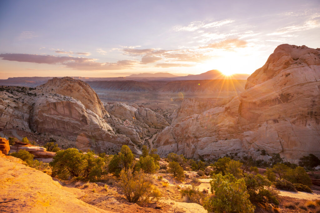
The hike is accessible all year, however, avoid doing it in the summer because it will be unbearably hot.
During the winter, the route may be covered in snow. The track is well-maintained and simple to follow. If you visit all of the views and spur tails, the route will be about 7 miles long. Everyone in your group should bring at least two to three liters of water. So, the best time to hike this trail is in the fall/spring, or the winter if there is no snow.
Except for comfortable hiking shoes, the Frying Pan requires no other gear. This route is simple to navigate and is suitable for beginners.
This hike does not require the use of a GPS, but the coordinates are provided for those who like to use one. The USGS 7.5′ Map labeled “Fruita” and map reading skills are helpful.
The trail starts at Cohab Canyon Trailhead and ends at Grand Wash Trailhead. This adventure requires a 3.4-mile vehicle or bicycle shuttle to complete.
Grand Wash is a popular trailhead, and hitching a ride back to Cohab Canyon Trailhead is usual. Hitchhiking will be much easier if there is a large, easy-to-read sign that says “campground.”
Brimhall Natural Bridge
Brimhall Natural Bridge is a double arch hidden deep within Capitol Reef National Park’s Brimhall Canyon, a tributary of Halls Creek in the Waterpocket Fold.

Many of the outdoorsmen and women who are ready to take on the challenging route that winds its way down from Halls Creek Overlook on the edge of Big Thomson Mesa consider the arches to be their favorites.
To get to Brimhall Bridge, cross Halls Creek and continue along the sandy beach until you come across a huge side canyon on your right. You’ll notice the difference between the two spots: Halls Creek has wide, dry benches, whereas Brimhall Canyon has small, shaded boundaries.
Halls Overlook also provides a glimpse of Brimhall Bridge. While the sporty character of the Brimhall Natural Bridge may attract you, this is a place only experienced hikers should explore.
Since the trail is mostly unmarked, it is recommended that you bring lots of water with you, as the water stations along the way are not always reliable. The hike will take you 4.6 miles round trip if you start from Halls Creek.
Bring a dry bag or some other way of transporting your clothes and cameras across the pool.
Grand Wash – easy hikes in Capitol Reef
For its accessibility, Grand Wash is one of the most popular walks in Capitol Reef National Park. This trip is well-known for its small valley with sheer granite cliffs.
In a small package, it provides a safe and enjoyable family-friendly activity. Although the round is 4.4 miles long, it may be done as a 2.2-mile one-way hike if you have two vehicles.
The hike to the narrows is roughly 1.2 miles long, and the wash is rather flat throughout; nonetheless, it is full of streambed debris, therefore athletic shoes or hiking boots are recommended.
To get to this trail, take the scenic drive south from the Visitor Center and continue driving for another 3.5 miles until you reach the Grand Wash road. From there, turn left and continue until you reach the trailhead at the end of the road.
Halls Creek Narrows
Capitol Reef National Park is home to Halls Creek Narrows, which is just a few miles north of Lake Powell.
Between the towering cliffs of Hall Mesa on the east and Waterpocket Fold on the west, the parking area lies. They stretch over nearly three miles and, unlike other areas, are quite pleasant in the summer
While there is no fresh water along the trail, there is water in the narrows’ bottom that requires wading and remains there all year.
Since it is long and arduous, most visitors make it a two or three-day camping trip. This amount of time, however, is plenty for hikers to explore the area’s dozens of side canyons. During this time, they can also explore Brimhall Natural Bridge and Muley Twist Canyon.
A three- to four-day hike is recommended for the round-trip hike. All overnight trips require a free backcountry permit, which can be obtained at the visitor center. The National Weather Service’s heat danger and flash flood potential rating are included in this weather forecast for Halls Creek.
Rim Overlook
The Rim Overlook Trail, located within Capitol Reef National Park, offers a spectacular view of the historic town of Fruita and the Fremont River, which is 1000 feet below.
This hike is ideal for all adults and older children who are in good health. This fantastic climb through the sandstone reef will be enjoyed by the entire family. This hike is especially enjoyable in the autumn when the orchards surrounding Fruita are ablaze with color.
The Rim Overlook Trail is not difficult, and any healthy adult or older child in ordinary physical condition can complete it. Other than walking shoes suitable for rugged terrain, no extra gear is necessary. The hike is roughly 2 1/4 miles each way on a well-maintained trail with a 1,100-foot elevation gain. The course will take about two or three hours to complete round trip.
Much of the route is in direct sunlight, and there is minimal shade. A hike in the early morning or late evening is suggested during hot weather. At least one liter of water should be carried by each member of your hiking group. This hike should be available throughout the year.
Capitol George – easy hikes in Capitol Reef
Capitol George is particularly well-known since it plays such an important role in the town’s human history.
Mormon pioneers used to navigate through the towering, 100-mile-long Waterpocket Fold, despite its extraordinary narrowness. Before Highway 24 was completed in 1964, this was the main road into the park.
From the Visitor Center, travel south on the Scenic Drive for about 8 miles before turning left onto the unpaved Capitol George Road.
The Capitol George Trail leads to two trails: one leads to a steep and moderately difficult climb to a viewpoint of the Golden Throne, while the other leads to an easy stroll around the George. The park’s Golden Throne has become a symbol.
A small petroglyph panel in a really beautiful narrow section is only 5-10 minutes down the canyon from the trailhead.
As you progress farther down the canyon, you’ll come across a magnificent Pioneer Register (30 minutes round trip). The tanks, as well as several enormous craters utilized for water and a small natural bridge, are the next stop.
Most people turn back at the tanks, but it’s a wonderful walk through the canyon to the park’s eastern boundary.
Sulphur Creek
Sulphur Creek, often known as the subway or narrow canyon of Capitol Reef National Park, offers visitors a magnificent water hike in a narrow canyon. The water is only ankle-deep, and you can easily navigate through three waterfalls. You’re forced to slide down a 5-foot drop by one of the waterfalls.
This hike requires a small amount of wading. Wear heavy wool or neoprene socks if you’re doing it in the early spring or late fall.
In most cases, you’ll be in ankle-deep water, with a few spots reaching knee-deep. It may run deeper after recent rainfall or in early spring. Before leaving, check the traffic flow at the visitor center to ensure it is reasonable. If storms are expected, this is not the hike to take.
Because of all the water, it may be enjoyable in the summer heat, and there are fantastic waterfalls to cool off in if you become too hot. It’s a bit long for small children at 5 miles, but it’s an excellent family hike for those who can handle it.
Consider hiking up from the bottom to the final waterfall if the distance is too great. This is a wonderful outing that only takes an hour or two roundtrips.
Cottonwood Wash
The most exciting feature of this location is that it offers four hikes instead of one. There’s a flat open path, a path that leads up the mountain, a rocky section, and a slot canyon.
Since the path may have pools of water, it is recommended that you wear shoes that are comfortable to walk in and clothing that dries fast.
Cottonwood Wash is one of the several slot canyons that run through the large white Navajo sandstone peaks and is located 9.1 miles south of Highway 24 on the Notom-Bullfrog Road.
Capitol Reef’s highest points are made up of these. Cottonwood Wash, like the other slot canyons in the area, is generally short but can get rather deep in places.
Surprise Canyon
Surprise Canyon should be on your list if you’re seeking a route that the whole family can enjoy. It’s a short and easy canyoneering route that runs through Capitol Reef National Park’s Waterpocket Fold. It is not a slot canyon, even though it is narrow.
The Narrows is one of Capitol Reef’s more accessible attractions, and they make for a perfect day’s adventure.
For most, the scenic turnaround point is near the end of the narrows, where there is small drywall and a potential pool. Canyoneers may be able to make it up the up climb since the fall is just tough enough. Others who are motivated can climb around the falls, although the canyon’s best stretch is now closed.
This location is frequently combined with Headquarters Canyon for a fantastic half-day trip. It is free of major obstacles, making it a wonderful spot for youngsters to visit. While the canyon is usually dry, if it has rained heavily in the area, you should expect some wadding.
Cathedrals Trail
Capitol Reef’s northern Cathedral District, a remote backcountry with no established roads, offers stark landscapes and a high degree of solitude.
The Waterpocket Fold’s northern flanks give way to wide deserts, spectacular monoliths, and volcanic dikes and crags. The Cathedral and Hartnet roads, which are only accessible by high-clearance cars; four-wheel drive is generally suggested, lead to several short hikes.
The Cathedrals Trail is a 2.4-mile out-and-back hike that follows a low ridgeline that runs parallel to the Cathedral’s monoliths.
The trailhead is located on Cathedral Road, 27.4 miles north of Highway 24 and just over two miles north of the Hartnet Road intersection.
The trail begins with a short, sharp ascent, followed by a rather level walk over the moderate ridge to the west, marked by a small wooden sign. At the trail’s end, there’s a small hill with a panoramic view of the Cathedrals and Upper Cathedral Valley.
These aren’t official, maintained trails; instead, they have canyon barriers that alter regularly owing to weather, flash floods, and rockfalls. Anyone attempting these backcountry adventures should be able to read a map and compass and not rely solely on unofficial route markings such as rock cairns.
Roads in the area are rarely maintained, and they can become inaccessible in the winter or during rainy conditions; check with the visitor center before heading out. There is no bridge at the south end of Hartnet Road near Highway 24; vehicles must ford the Fremont River. During floods or any other time when the river is high, vehicles should not attempt to cross it.
Cohab Canyon
Cohab is the first canyon south of the Fremont River in Capitol Reef, and it can be accessed from either the west or the east, either from the campground or directly from the Hickman Bridge Trail parking lot across the highway.
Cohab Canyon leads to the Frying Pan Trail, which in turn connects to the Grand Wash Cassidy Arch Trail, allowing you to see the northern half of the Waterpocket Fold. This hike is 1.56 miles long and moderately challenging (one way).
This trailhead is the most popular because it is closest to both the visitor center and the campground; it has a small parking area near the start of the path, or cars can be parked further back along the road next to an old wooden building (Gifford Barn), one of several original structures in Fruita dating from the early twentieth century.
A location at a high altitude Waterpocket Fold in Cohab Canyon, Capitol Reef National Park, is a popular tourist destination. Its lower end leads into the gorge alongside Highway 24, while the top end leads to Fruita’s historic village. From March through November, Cohab Canyon is a moderately strenuous hike.
Strike Valley Overlook
Strike Valley Overlook at Capitol Reef National Park is another breathtaking location. The 6-mile out-and-back hike to Strike Valley Overlook is moderately trafficked.
It contains some gorgeous wildflowers. In addition to hiking, the trail can be used for natural adventures and off-road rides. In addition to hiking, the trail can be used for natural adventures and off-road rides.
This is a remote viewpoint, and getting there can be challenging. If you’re planning to Loop the Fold, you’ll pass right past this viewpoint. From Burr Trail Road, a 3-mile access road leads to the trailhead.
Standard cars will only be able to drive a quarter of a mile along this road before having to park and walk the rest. The parking area should be accessible to high-clearance cars, however, 4WD may be required in some cases.
The best time to visit is from March through November.
Chimney Rock
The Chimney Rock Trail, which runs alongside UT 24 just inside Capitol Reef’s west gate and offers the shortest climb to a high elevation viewpoint, travels through a variety of scenery, including colorful badlands, tall cliffs, and the mouth of a narrow canyon.

The trail begins flat but gradually becomes a series of switchbacks that ascend to the summit of the mesa. This is the first of three sections of the hike where you will gain altitude.
The trail flattens out until you reach the top of the Mesa, where the vistas become truly breathtaking. The level section of the trail doesn’t last long before the second rise begins. These inclines will put anyone in poor physical condition to the test, but they aren’t too bad.
The trail swiftly approaches the base of a cliff encircled by huge stones which have broken off the rock and fallen. It swings sharply east and climbs until it reaches the loop’s end after passing past the boulder graveyard. This also runs parallel to an area of massive red sandstone cliffs on the right.
The trail is completely exposed in the summer, with minimal shade, making it a very hot hike. Always remember to bring plenty of water and a hat.