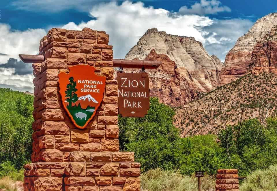
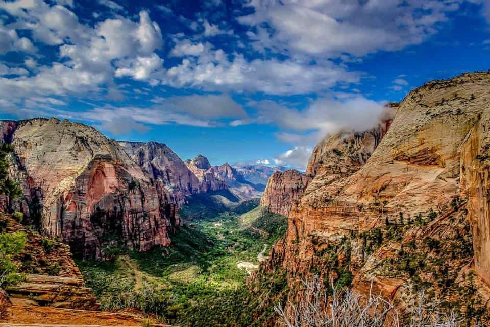
Visiting Zion National Park in March
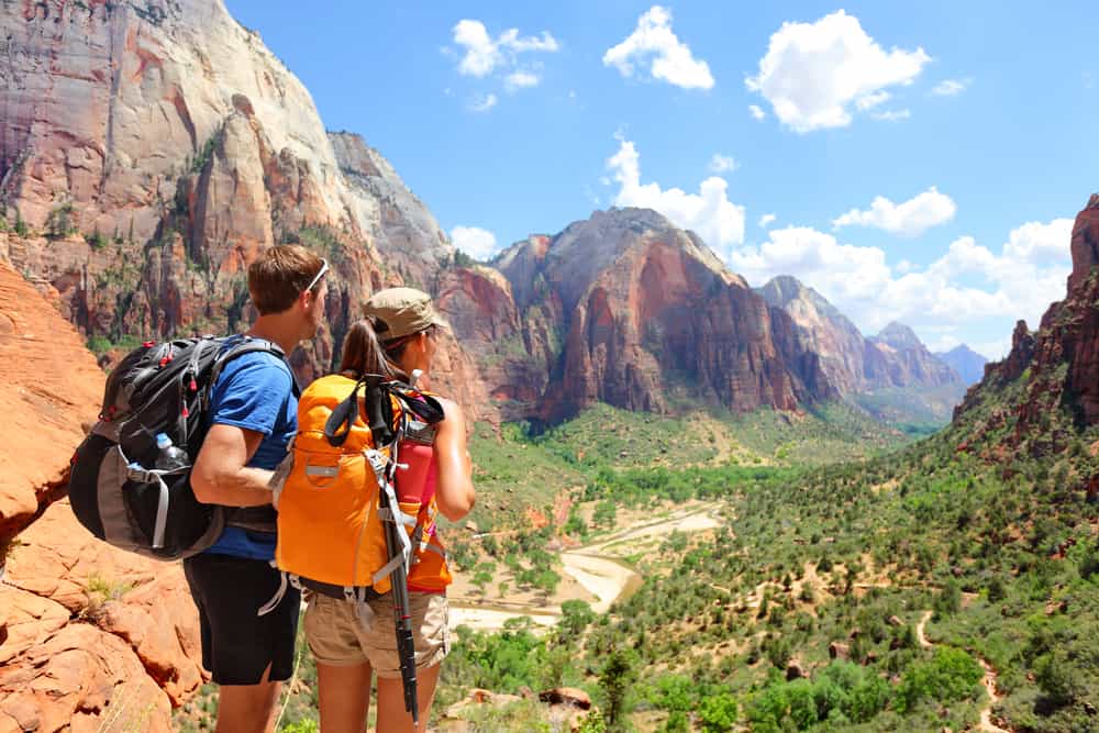
Visiting Zion National Park in March allows you to take in the fresh, crisp air of winter transitioning to spring, see spectacular scenery blanketed with snow, and have plenty of space to appreciate it all. If you visit Zion in March, you will have a magnificent time and leave with a deep appreciation for the grandeur and serenity of the park, which few people get to see.
The lack of crowds is the major advantage of visiting Zion in March. As there are fewer people in the park, you can appreciate the size of the walls without the noise and bustle of summer crowds.
Another advantage is that the shuttle bus service begins in March and takes you to the canyon’s most popular trailheads. You won’t have to worry about driving your own car or finding a parking spot because this is the only way to go around Zion Canyon. The Visitor Center has shuttle bus parking, as well as parking outside the park in Springdale.
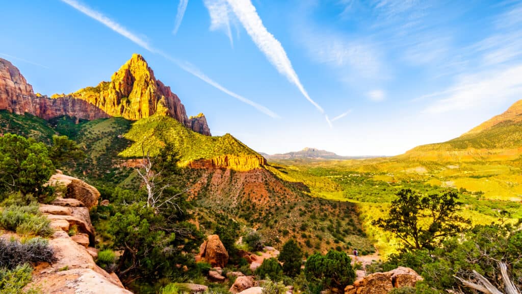
In March, the countryside is extremely stunning. Although the snow on the walls and formations at higher elevations may melt as the day passes, there is nothing like morning photography in Zion this time of year.
Hiking is another fantastic thing to do in March since it allows you to see the best of Zion from a variety of vantage points. In March, most trails are open, allowing you to appreciate the beauty without the crowd that you might encounter at other times of the year.
Accommodations are available and less expensive than during the busiest months because there are fewer tourists. Most hotels and motels in town allow you to walk in and obtain a room without making a reservation (although calling ahead is recommended, particularly on holidays, to reserve your accommodations).
Things to do in Zion in March
Emerald Pools
Emerald Pools features a weeping wall and pools at the base. A.6-mile round-trip paved trail leading from the Zion Lodge shuttle bus stop #5 leads to the site.
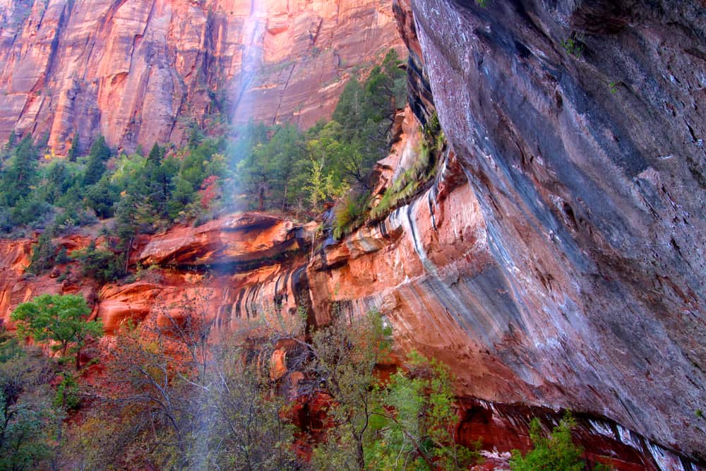
This paved trail is located across the street from Zion Lodge and allows strollers and wheelchairs to navigate up to this small sanctuary. Water from the Middle Emerald Pool above cascades down the sandstone and into the Lower Emerald Pool, sustaining beautiful hanging gardens and occasionally transforming into a true waterfall during spring runoff. In the heat of a Zion summer, when you feel like you’re going to curl up and turn to sandstone, take a break at Lower Emerald Pool.
In the spring, when the leaves are out and the water is running over the wall, this is an especially lovely walk. If you have more time and energy, you can continue on to the Middle and Upper Emerald Pools by hiking behind the falls.
The Emerald Pools hiking routes are also accessible from this location. The Lower Emerald Pool trip takes about an hour and is more like a pleasant stroll. If you want a lengthier hike, continue on to the Upper Emerald Pool and the Kayenta Trails.
Water flows from the higher pools to the middle and lower pools, forming light waterfalls. The area is extremely lush due to the regular moisture, and the Virgin River sparkles on a sunny day!
Prepare to share the trek and the vistas with others.
Angels Landing
The Angels Landing route leads to an elevated vantage point, as its names indicate. During the 5.4-mile round-trip climb, hikers will ascend 1,488 feet, with some sheer cliffs and steep slopes that may be mentally demanding for individuals who are afraid of heights.
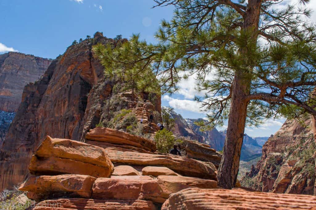
Hikers should turn around at Scout Lookout (which also has bathrooms), as the final section of the trail to the landing involves gripping chains to retain your footing on the precipitous drop-offs.
Angels Landing trailhead is located in the Grotto Picnic Area in Zion Canyon, and it is most popular in the spring, summer, and fall. The trail can be dangerous in the winter due to icy conditions, and it can be hot in the summer. If you’re hiking in the summer, start early to avoid the heat of the midday sun.
At the trailhead, there are facilities; hikers should bring water and snacks in a backpack so that they can hold the chains with their free hands on the last ascent. Angels Landing is accessible through the park’s complimentary shuttle and is included with park admission.
This is a strenuous hour-long hike that is not suitable for children or anyone with a fear of heights. You should hike during the week as the trail gets packed on weekends.
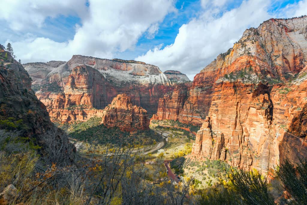
Observation Point
Observation Point, perched at 6,521 feet atop Mount Baldy and extending out into one of Zion Canyon’s widest portions, just around the Big Bend, boasts a view of practically every significant site in the canyon. Hikers are treated to a breathtaking perspective of Zion Canyon’s bottom end, which extends beyond the canyon’s mouth.
The hike itself is quite strenuous, with only a few short intervals of comfortable, level walking through Echo Canyon. Hikers gain roughly 2,000 feet in elevation on this hike; this is not a trip for the sedentary or out-of-shape tourist. However, if you pace yourself and stay hydrated, this can be a pleasant, tough hike that will leave you satisfied both in memory and in photographs.
As you near the top, you’ll see a slow ascent up switchbacks. At one point, you cross through a slot canyon, and the rest of the trail is switchbacks all the way to the top. The top trail is a single-track dirt path that leads to the point. This hike offers some of the park’s most breathtaking views. It concludes at a vantage point that allows you to view all the way down and back up the canyon — well worth the time and effort!
Hidden Canyon
Hidden Canyon is a rather extrenous side trip from the Observation Point Trail, with a cliff-hanging start and a climb up a trail-less wash between towering sandstone walls at the end.
From the trail intersection, the path zigzags upward before skirting westward around a rocky promontory. It rapidly descends into a tight passage with handrails made of chains in hazardous places. As it continues westward above a drop-off of early a thousand feet, the road becomes even more nerve-wracking. The road bends southward towards the mouth of Hidden Canyon after a few hundred yards.
The place is a narrow and deep “hanging canyon” hidden above the main canyon east of the Great White Throne. The constructed trail rises up the east side of the main canyon, traverses a few ravines, and finishes at the mouth of Hidden Canyon, allowing hikers to go as far as they like up the canyon.
With an elevation rise of over 1000 feet, some exposed sections, and plenty of rock scrambling in Hidden Canyon, this trip is fairly strenuous. Depending on how much you wander, it could take anywhere from 3 to 6 hours.
Small sandstone caves and a 20-foot natural arch can be found along the trail. There are also some very steep thin tracked rock parts on the trail. Although there are chains to safeguard hikers in some areas, all hikers should exercise caution. Some sections of this may be tough for those who are afraid of heights.
Drive through the Mt Carmel Tunnel
The Zion-Mount Carmel Highway, which runs from the South Entrance to the East, is perhaps as beautiful as the Zion Canyon Scenic Drive, but it offers a completely different perspective as it winds high above the valley providing stunning vistas from one side to the other.
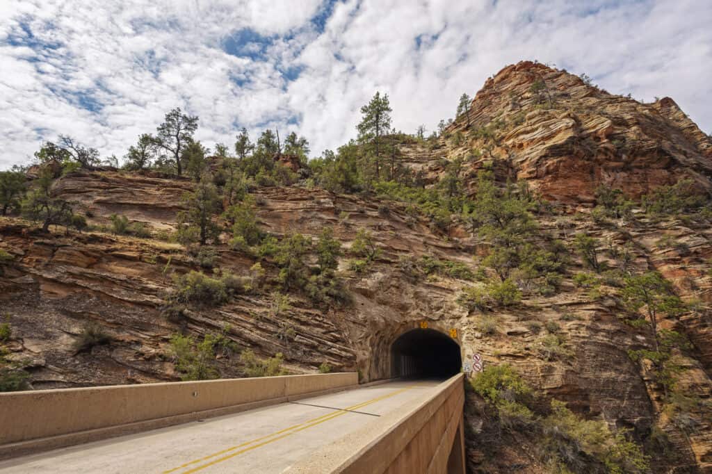
This is a must-do activity. In fact, you should plan on driving it more than once! Prepare for an astounding, fantastic, and even daunting drive with massive slabs of beautiful granite towering over you on all sides.
As it rises up the mountainside, the road follows the rock wall. The road runs via a narrow 1.1-mile tunnel after a steep ascent. Since the tunnel is too narrow for RVs to pass through, traffic is diverted in one way when RVs enter the tunnel. To pass through the tunnel, RV drivers must pay a fee when they enter the park, and a pass must be obtained in advance before you and your RV may proceed.
The parking area for the Canyon Overlook Trail is visible immediately after exiting the tunnel on the east side. The terrain transforms to rolling ridged mountains with orange and cream colors beyond this point.
This section of the park is higher, cooler, and home to a few huge pine trees.
Along this route, there are numerous roadside pullouts that provide convenient observation sites. This route is not served by the shuttle.
Visit Kolob Canyon
A day in the northwestern Kolob Canyons is ideal for visitors looking to get away from the crowds in Zion Canyon. The Kolob Canyons, located 17 miles south of Cedar City, Utah, are known for their beauty and tranquillity. It’s easy to see why this portion of the park was named Kolob, which means “residence closest to heaven” in Mormon scripture.
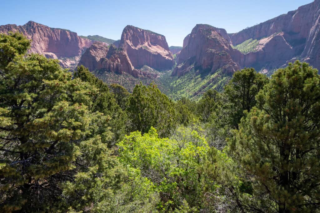
Visitors are treated to lush desert canyons, cascading waterfalls, and Navajo sandstone summits. You can drive along the 5-mile-long Kolobs Canyon Road to soak in the sights, arrange a hike, or do both while you’re here. Three out-and-back trails, ranging in length from 1 to 14 miles, are accessible.
Recent visitors to this section of the park raved about how much fun they had. Travelers were relieved to discover that the Kolob Canyons had far less foot traffic than Zion Canyon, and some even found it was more beautiful.
The perspective from this mile-long trail is so expansive that hikers may be able to see for up to 100 miles. Kolob Canyons is not accessible from the park’s main entrance; instead, you must enter from the park’s west entrance.
The park’s entrance fee covers access to Kolob Canyons. The Kolob Canyons Visitor Center has restrooms, and the Taylor Creek trailhead, South Fork parking area, and Kolob Canyons Viewpoint all have vault toilets. If you’re visiting the Kolob Canyons in the winter, be aware that due to icy conditions, this portion of Zion may be closed.
Kolob Canyon is also a fantastic place to see the sunset. Timber Creek Overlook, a short climb at Kolob View Point, offers nearly 360-degree views, reaching as far as the north rim of Grand Canyon National Park and adjacent rock formations as they light up during golden hour.
Hike Canyon Overlook Trail
Looking for the ideal, wide-angle view of the valley floor? Canyon Overlook Trail, which leads to an overlook that has fascinated photographers for decades, is a must-see. Hang on to your children because there are some cliff edges here, but otherwise, this is a trail that every hiker can (and should) do. The trailhead is located at the Mount Carmel Tunnel’s east entrance.
One of the easiest and most photographed trails in Zion National Park, Canyon Overlook Trail is also one of the busiest. This trail is only a mile round trip and takes hikers 100 feet from the parking lot to the overlook, where they may enjoy spectacular views of Zion Canyon.
To get to the trailhead, take Highway 9 to the Mount Carmel Tunnel’s east entrance. You can park your car on the south side of the road and walk up to the trail on the north side. The route is free to use with park entrance (a weekly permit costs $35 per vehicle or $20 for those who enter on foot or by bike). It’s worth noting that the park’s shuttle service does not stop here.
This one-mile hike off the Zion-Mount Carmel Highway takes you to a high vantage point with magnificent valley views: Curving around the side of a mountain, hugging the cliff wall, swerving out onto a wooden footbridge stretched over a drop-off, and affords amazing vistas around every bend.
Hike the Watchman Trail
Watchman is an excellent moderate path for people want to get away from the crowds, gain elevation, and get near to the mountains. You’ll have a great view of Watchman Peak and the lower part of Zion Canyon, including the Visitor Center.
The Watchman Trail is a 3-mile round-trip hike that provides a stunning view of the Watchman Spire, as well as the broad valley underneath it and some desert cacti and greenery along the route. It’s a wonderful trail to start out on for those new to hiking because it only ascends about 400 feet.
Travelers described it as a “nice moderate hike,” though others recommend doing it early in the day to escape the intense midday sun. Because the trailhead is close to the Zion Canyon Tourist Center, foregoing the long queues for the free shuttle and instead heading straight for this path is recommended.
The Watchman Trail begins near the tourist center, directly across from the shuttle stop. Bring plenty of water, apply sunscreen, and begin your hike as soon as possible, as this trail is completely exposed to the scorching Utah heat.
This hike is best done in the late evening or at sunset. The canyon opens up to the southwest south of the Watchman, and the late evening light from the setting sun bathes the canyon’s eastern walls in golden light.
While the trail does not lead to the summit of Watchman Mountain, it does provide a good view of the famed and spectacular peak to the south, as well as a bird’s eye view of the entire Visitor Center complex below
Hike the Narrows
The Narrows is the narrowest stretch of Zion Canyon and one of the park’s most popular hikes. Set off from the Temple of Sinawava down the Riverside Walk for a one-mile, wheelchair-accessible hike with a good view of The Narrows to experience it. Since the pathway goes into the Virgin River, you’ll have to wade or even swim upstream if you want to go any further. You’ll get awe-inspiring vistas of the striated, orange-red canyon along the way.
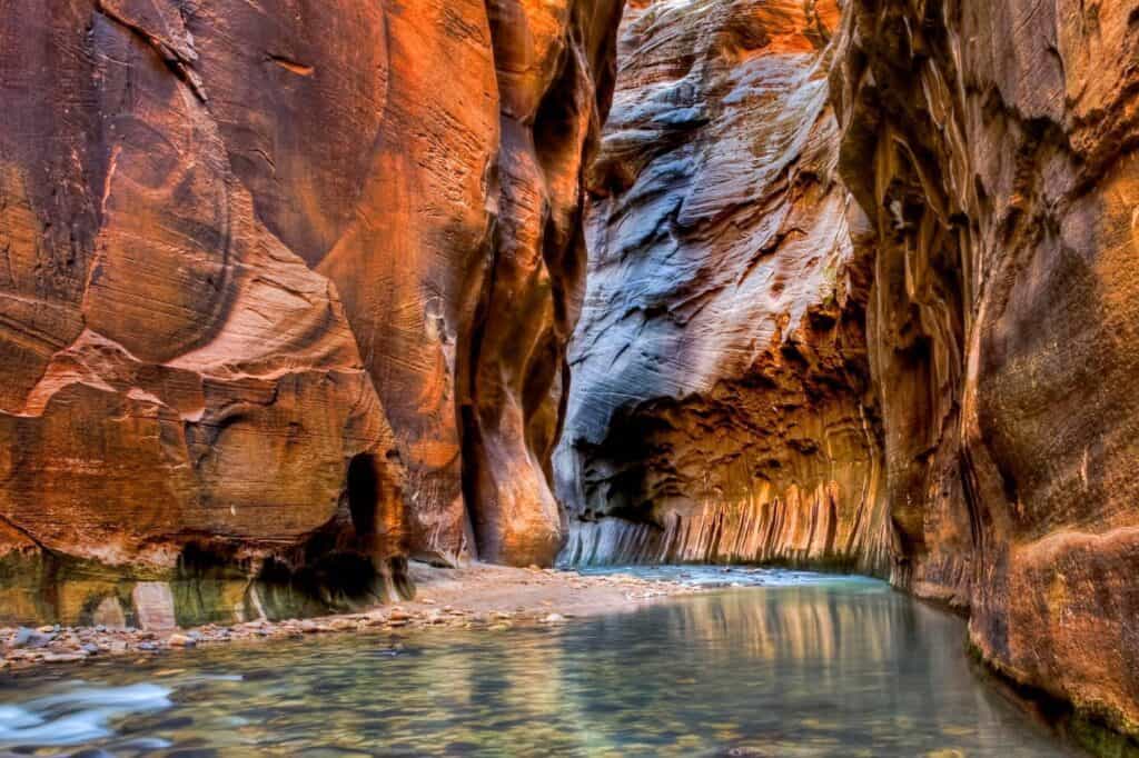
Water can rise as high as your waist in some locations, so travelers consider putting any valuables in a waterproof bag depending on the time of year, the National Park Service says the waters can rise as high as your chest. You’ll also need a hiking stick and waterproof shoes, because the rocky, slippery terrain can’t be navigated with bare feet. To avoid congestion, hikers should arrive at The Narrows early (before 8 a.m.).
The Narrows is most popular for hiking in late spring or summer, when the water levels are at their lowest and the air temperatures are at their warmest. When storms are expected, however, you should skip this trip because The Narrows can swiftly fill with life-threatening flash floods.
Many visitors take a 10-mile round-trip climb upstream from the Temple of Sinawava to Big Stream, which does not require a permit. You’ll need a permit to hike 16 miles downstream from Chamberlain’s Ranch, which you can reserve here. The Narrows is free with your park entrance fee and there are no set hours of access.
The Narrows, Zion’s most famous feature, is the slot canyon of all slot canyons, and hikers who don’t mind getting wet can follow the Virgin River down this stunning rock-cut. Hikers can walk, trek, and swim in a tight canyon encircled by massive red sandstone canyon walls, where the Virgin River has worked for millions of years.